Baifu Canal - Final Stretch
Place your mouse on any photo to pause slide show


Last Mountain View (1/6)
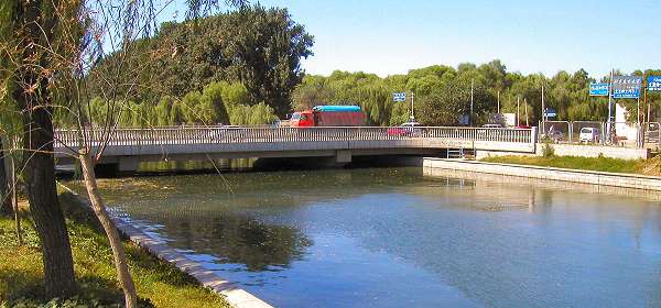
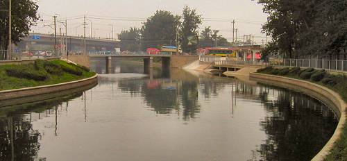
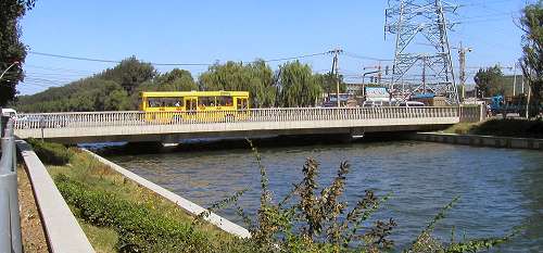
Baifu Canal now swings back slightly northernly. The relatively long distance to the previous crossing causes this bridge to be quite congested.
From this bridge one can catch a last glimpse of the mountaineous part of Western Hills -see the small inserted picture right.
Note the very low clearance between the water level and the bridge. The following bridge has a quite different construction.
More Crossings (2/6)
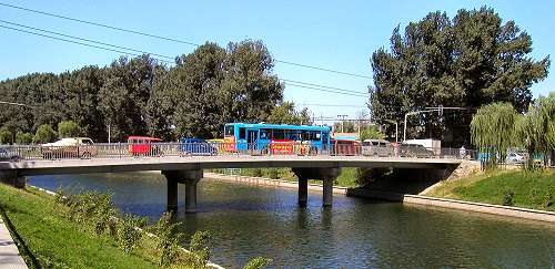
The next bridge (at red arrow on the colored map) has been elevated further on two sets of double circular columns -top photo.
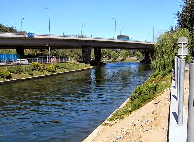
The lower photo shows another low elevation bridge built on concrete slabs. It is located at the blue arrow on the colored map.
Both bridges are increasingly being congested as they are in the vincinity of a rapidly growing suburb.
The next bridge (at red arrow on the colored map) has been elevated further on two sets of double circular columns -top photo.
The lower photo shows another low elevation bridge built on concrete slabs. It is located at the blue arrow on the colored map.
Both bridges are increasingly being congested as they are in the vincinity of a rapidly growing suburb.
5th Ring Road (3/6)
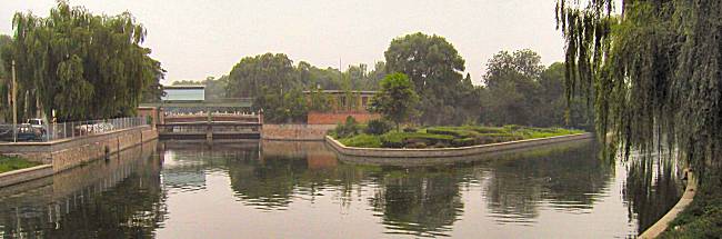
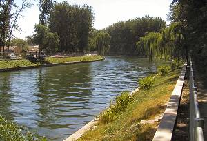
The canal glides gently past weeping willows and small communities (photo far left) on its last part before entering civilization at large. A wide bend left followed by ...
... a final major bend south and Baifu Canal meets up with Beijing's Ring Road 5 and a buzzling urban sprawl (photo left).
The irrigation canal is nearing the last kilometer of its long journey from Baifu Spring.
But Beijing's Water Management still has a couple of surprises left for us before we reach Kunming Lake and the Summer Palace.
Qing River Overflow (4/6)
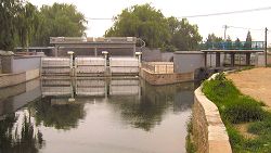
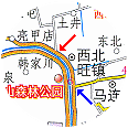
After passing under 5th Ring Road and the local east-west trunk road -both visible on the photo, Baifu Canal is nearing Kunming Lake, the excavated natural lake, which functioned as a regulating water reservoir.
But whereas in the late 1200's Ba River served as an overflow safety valve, today Beijing Water Management has found a more northernly solution avoiding using the inner city for unwelcome flooding test. On the right of the photo you see a sluice (red arrow). This opens up into Qing River (see the inserted large map for details).
Flowing eastward, this river makes a gigantic swing northwards emptying into none other than Wenyu River.
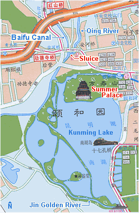
Jin Golden River (5/6)
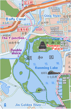
Baifu Canal flows under yet another local bridge and curves its way till it unexpectedly divides into two at a Y-junction!
On the left Baifu Canal ends its long journey by emptying into Kunming Lake. A sluice port prevents Kunming Lake from overflowing.
On the right however, the canal joins the Jin Golden River, which runs further south until it meets up at a double sluice (small photo right) with its origin coming from west (see map).
Last Bridge (6/6)
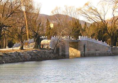
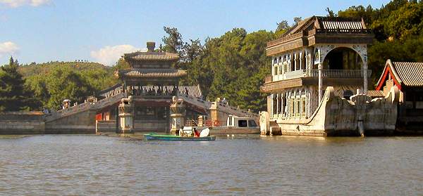
The small photo right shows the bridge under which Baifu Canal flows into the northern channels of Kunming Lake.
The larger photo above depicts the very last bridge the waters flow under to finally arrive at the lake proper. The bridge is finely decorated and is covered with pavilion.
It is empress dowager Cixi's infamous marble boat built in the late 1800s on the right of the photo.
And so is it that Guo Shou Jing's Baifu Canal -an engineering masterpiece of the 1200s and even of today- finally empties its waters into Kunming Lake. Our journey has ended.