Baifu Canal - 1st Run
Place your mouse on any photo to pause slide show


First Bend (1/6)
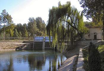
After passing under a narrow bridge serving as an entrance to a small village, Baifu Canal reaches its first bend.
This photo from 2004 looks directly west. The narrow bridge can be seen in the back. The road on the left leads down to Baifu Spring.
The canal bends 45 degrees south and now approaches the Badaling Expressway.
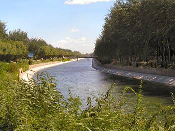
Badaling Expressway (2/6)
This 2004 photo shows Baifu Canal flowing under two main traffic arteries: The Badaling Expressway and the main local north-south Changping county highway.
Badaling Expressway wisks hundred of thousands of tourists from downtown Beijing to the Ming Tombs and The Great Wall at Badaling. Hardly any of them realize that they are riding over the main source of their evening drinking water back at their hotel.
The bridge in the rear carries the eastern main Changping County north-south highway. After construction of the expressway this heavily congested road was relegated to local traffic, which made it far more passable.
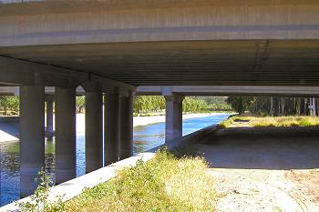
The 69 Marker (3/6)
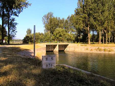
The canal now winds gently through rural areas. The tree lined render a quiet and calming athomsphere.
It bends further southwards at the 69 km marker as can be seen on the photo and continues straight for another one kilometer until it meets its first major obstacle at the 70 km marker.
The canal now winds gently through rural areas. The tree lined render a quiet and calming athomsphere.
It bends further southwards at the 69 km marker as can be seen on the photo and continues straight for another one kilometer until it meets its first major obstacle at the 70 km marker.
Double Cross (4/6)
Just before the 70 km marker the canal abruptly ends. Or at least that what it looks like.
The photo shows this apparent termination. The building on the right is the station master lodge for the rail road, which runs right-left just behind the dam and lodge.
What is less apparent is that the water is piped onwards deep under the rail road. But adding to this complexity is that also a small river is crossing the canal just behind the rail road.
So the water not only runs underground under a rail road but also under a river.
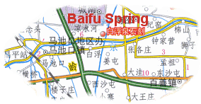
The crossing of both of these can be seen on the map above.
Just before the 70 km marker the canal abruptly ends. Or at least that what it looks like.
The photo shows this apparent termination. The building on the right is the station master lodge for the rail road, which runs right-left just behind the dam and lodge.
What is less apparent is that the water is piped onwards deep under the rail road. But adding to this complexity is that also a small river is crossing the canal just behind the rail road.
So the water not only runs underground under a rail road but also under a river.
The crossing of both of these can be seen on the map above.
The 70 Marker (5/6)
We are still back at the double crossing but now looking north-east from where the canal continues its downstream flow.
The white rail road station master house is nested in the trees far left. To the right of the house is the fence running alongside the rail road tracks.
The water exits the underground piping at the narrow end of the canal. The river runs from left to right some 3-4 meters down between the narrow part of the canal in the front and the rail road tracks in the back.
The smaller photo shows the river in the front running past the back of the narrow end of the canal higher up.
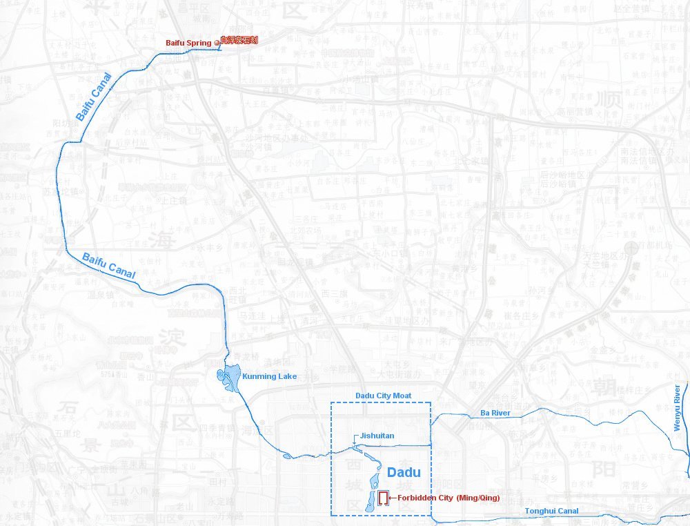
A Quiet Stretch (6/6)
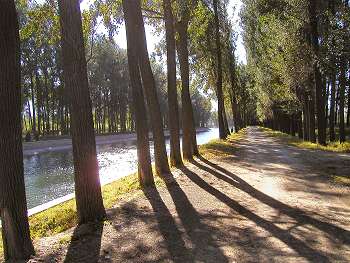
The canal continues a gentle flow for another couple of kilometers.
You can actually drive alongside the canal most of the way. Beware however that on this particular section there are large concrete roadblocks every 4-500 meters.
The road blocks prevent access for heavy trucks, but with a little skill you can navigate through with a regular passenger car.
The photo was taken close to the 71 km marker on a late sunny afternoon in September 2005.