Baifu Canal - West section
Place your mouse on any photo to pause slide show


Westernmost Point (1/6)
Baifu Canal now travels through its western section. It is unique in the sense that one would have expected a water canal north of a city to run straight north-south -that is, the shortest distance.
Instead, the canal makes this gigantic swing west and then skirts the Western Hills of Beijing for many kilometers in this section of the canal.
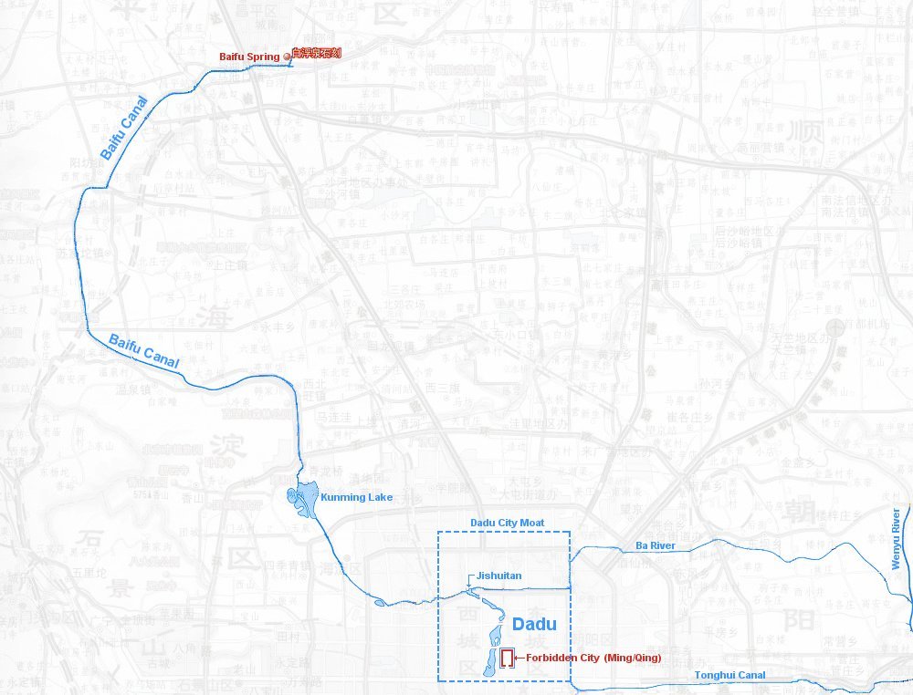
The photo looks north and is taken from the soft bend at the westernmost point of the canal (arrow).
The backdrop are the northern section of the Western Hills and in the distance a small, local bridge is crossing the canal. Behind it a river traverses the canal, but that is barely visible on the photo.
Baifu Canal now travels through its western section. It is unique in the sense that one would have expected a water canal north of a city to run straight north-south -that is, the shortest distance.
Instead, the canal makes this gigantic swing west and then skirts the Western Hills of Beijing for many kilometers in this section of the canal.
The photo looks north and is taken from the soft bend at the westernmost point of the canal (arrow).
The backdrop are the northern section of the Western Hills and in the distance a small, local bridge is crossing the canal. Behind it a river traverses the canal, but that is barely visible on the photo.
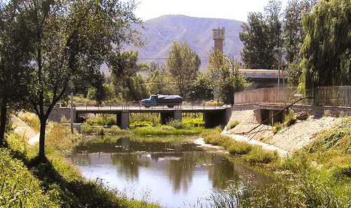
River Crossing (2/6)
A little south of the westernmost point the canal again is channeled underground, piped under a flowing river; see the small red arrow on the color section of the map.
The photo shows this crossing. In the foreground is the northern concrete embankment of the canal. In the background is the southern embankment behind which the canal continues its journey south.
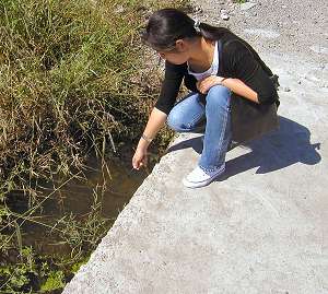
Since the footpath on the right appears rather dry, you might wonder where the water of the crossing river is?
It is indeed there; the small photo shows how water trickles under the dry surface of the footpath. Also, the soil under the grass between the two embankments is pretty soggy.
A little south of the westernmost point the canal again is channeled underground, piped under a flowing river; see the small red arrow on the color section of the map.
The photo shows this crossing. In the foreground is the northern concrete embankment of the canal. In the background is the southern embankment behind which the canal continues its journey south.
Since the footpath on the right appears rather dry, you might wonder where the water of the crossing river is?
It is indeed there; the small photo shows how water trickles under the dry surface of the footpath. Also, the soil under the grass between the two embankments is pretty soggy.
Finally Going East (3/6)
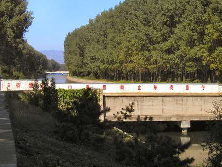
This is the location where Baifu Canal finally begins a real serious eastward direction towards Beijing.
This bend is also where Beijing's Ring Road 6 crosses the canal. On this photo from September 2005, the ring road is still under construction as evidenced by the orange public work trucks on top of the bridge.
Note an interesting error on the colored map: The sixth ring road is projected to cross over the canal north of the local east-west road (yellow on map).
The photo looks north and the local road being behind the ring road is therefore clearly opposite to what the map shows.
The Last River Crossing (4/6)
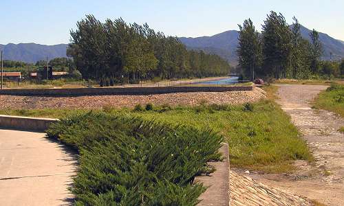
Some three and a half kilometers further downstream Baifu Canal meets up with its last river crossing. The small red arrow on the colored section of the map shows the spot.
This lies about a hundred meters after the western main Changping County trunk road crosses the canal and terminates.
As can be seen on the photos, this tributary river has plenty of water even this late in the season (September).
The large photo looks southwest; the road in the background is the (yellow) road which runs alongside Baifu Canal almost all the way to Kunming Lake.
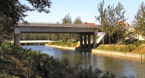
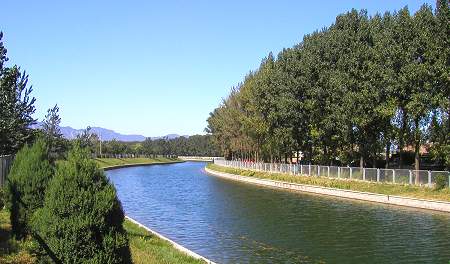
An Elegant S-Curve (5/6)
Complying with local topography conditions, the canal makes an elegant S-curve to maintain a perfect gradient.
The photo looks west-northwest and was taken in September 2005.
Complying with local topography conditions, the canal makes an elegant S-curve to maintain a perfect gradient.
The photo looks west-northwest and was taken in September 2005.
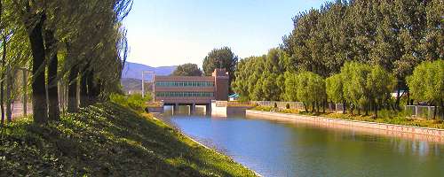
Water Management (6/6)
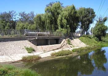
The photo left shows a rather common approach by Beijing Water Management.
They often construct their offices across the rivers and/or canals that they manage. And even though not the case in this location, the buildings are mostly placed on top of sluices.
This is actually a pretty smart way of reducing real estate cost: No need to build on expensive land.
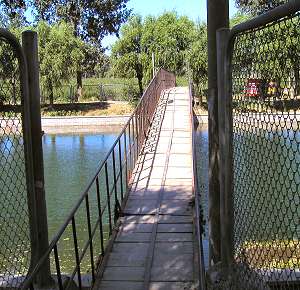
The photo below demonstrates a neat way of creating access for pedestrians where the distance between two regular bridge crossings is too great.
A simple footbridge is all that is necessary to connect the two banks. This is often used where there is a bus stop on both sides.
The photo left shows a rather common approach by Beijing Water Management.
They often construct their offices across the rivers and/or canals that they manage. And even though not the case in this location, the buildings are mostly placed on top of sluices.
This is actually a pretty smart way of reducing real estate cost: No need to build on expensive land.
The photo below demonstrates a neat way of creating access for pedestrians where the distance between two regular bridge crossings is too great.
A simple footbridge is all that is necessary to connect the two banks. This is often used where there is a bus stop on both sides.