Ba River - Final Run
Place your mouse on any photo to pause slide show


Another Bridge - Another Sluice
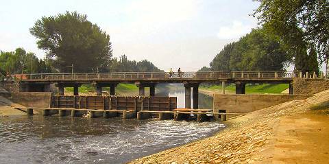
After a long, peaceful flow the river again meets a regulating sluice. As often is the case, sluices are built in connection with a road crossover. A narrow, separate footpath enables access to the individual sluice ports.
On this photo looking west from the northern bank, the northernmost sluice port has been opened to let water drain downstream.
Irrigation
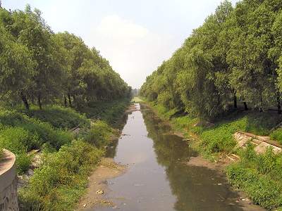
The landscape has many man-made irrigation canals, which channel surplus water into the rivers proper.
These canals are frequently polluted and have a rather foul smell. The almost romantic depiction here with tree lined banks is rather deceptive;the channel gives off a foul odor attracting innumerous flying insects.
A Mature River
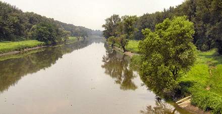
Ba River now widens significantly and carries plenty of water. This is the mature part of the river and less altered by man, clearly evidenced by the much older and larger trees lining the river.
Concrete linings are still used to regulate the flow, but occasional floodings leave sufficient moisture to allow a lush growth on both lower banks. Note the irrigation canal front right on the photo, which looks northwest.
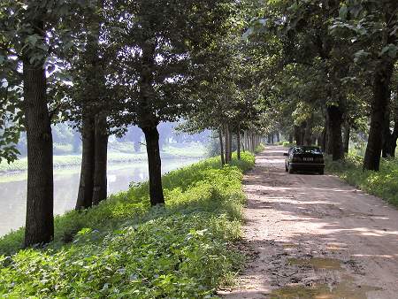
A Misty Morning
The river flows under its last major highway, which also has a sluice attached. This is actually the last sluice regulating Ba River. From here on there is no more obstacles in the flow to its end.
A small dirt road runs alongside the southern bank of the river. It was barely passable for my car (photo) on the day that I visited the misty river, since heavy showers the day before had left the road muddy and slippery amidst its many potholes.
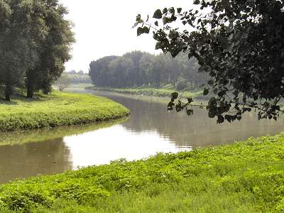
Last Soft S-Curve
A little more than one kilometer from its end, the river flows through its last, soft double curve, clearly visible on this photo that looks south-southeast.
This is a particularly peaceful section of the river due to the poor accessibility. In the early summer morning the only sound is the singing of the birds and chikades. Meanwhile, the spiders in the undergrowth are busy re-building their webs after the evening rain.
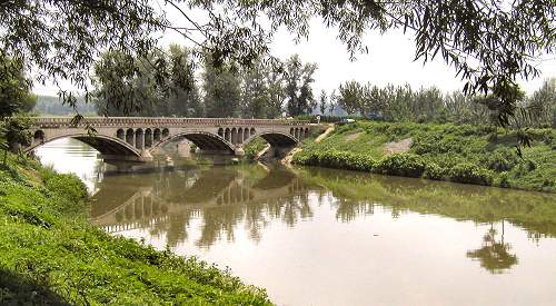
And the Last Bridge
For the last 500 meters the river runs gently and wide in a south-southeastern direction. Some 100 meters from its end it meets up with its final crossing, a narrow and simple triple-curve structure resting on two pillars.
The one-vehicle wide bridge is mostly used for local traffic and by the golfers who play on the golf course located on both banks of Ba River's outflow into Wenyu River.
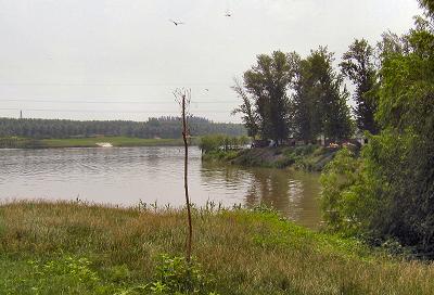
The Mouth of Ba River
This photo shows where Ba River in a gentle flow joins up with Wenyu River. The photo faces south-southeast, i.e., downstream and is taken from the golf course on the northern bank of Ba River.
We have now completed our journey of the Ba River from its current origin at the northeastern corner of the former Ming- and Qing dynasty Beijing city moat, through residential and industrial areas as well as farming communities and all the way to its end at the Wenyu River.
On this warm summer morning the dragonflies were swarming (can you spot them?) and the golf attendants rested in the cool shade of the trees on the river's southern bank. And with that quiet and peaceful picture we leave Ba River.