


Relatively few bridges cross Tonghui canal inside of Tongxian proper, as also is evident fron the inserted detail map below.
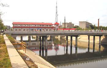
This lack of capacity obviously leads to congestions on the few there are.
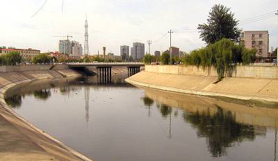
The one in the rear is a six-lane highway, but even that is insufficient.
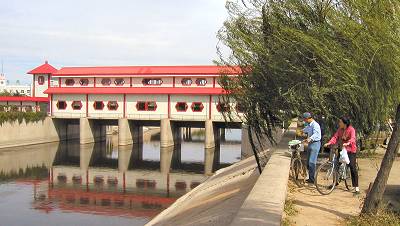
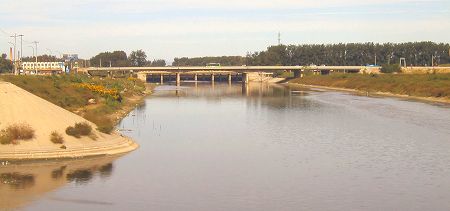
Water management has built a stylistically very adequate mini office at this, the last sluice gate. At the time of this photo all gates were opened allowing a free flow of water all the way to the Grand Canal
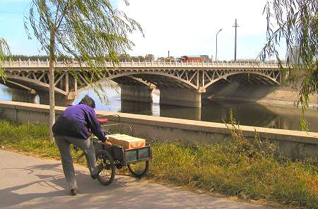
The sluice sits adjacent to the last in-city bridge carrying an eight-lane major traffic artery (photo below).
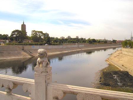
This is the last section of Tonghui canal before it joins Wenyu River and The Grand Canal. The red sluice building of Water management can be spotted in the far background, right.
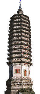
On the left the Randengta, or "Light the Lamp", Pagoda towers in a small park area.
There are contradicting tales of this pagoda: Ms. Eleanor Liu ("Off the beaten path in Beijing") maintains that it was constructed in the Liao dynasty (AD 946-1125).
Kevin Bishop ("China's Imperial Way") claims that it was built in the Northern Zhou period (AD 557-581), a good 400 years earlier. Bishop bases himself on the journals of Sir George Leonard Staunton, secretary to Lord Mcartney, Ambassador to the Imperial Qing court in 1793. Either way, the pagoda pre-dates The Great Wall as we know it today!
But more importantly, they all agree that the pagoda was a beacon greating weary travelers who had reached the northern end of The Grand Canal. They also agree that it is not a temple.
Made of brick, the pagoda has 13 stories, each distinguished by an outside belt of brick (Stauton claims there were only 11 stories?). More than 2,000 wind bells are suspended from the eaves of the stories.
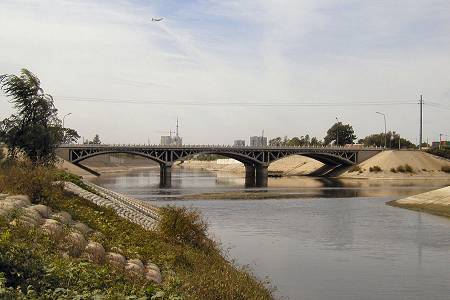
We have arrived at the end of the Tonghui Canal. This is where the canal joined -and still joins- The Grand Canal thereby ensuring that Beijing could even exist.
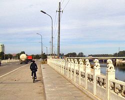
Today, two large, parallel bridges each carrying a five-lane, heavy traffic highway span this historic point rather unceremoniously.
The only sign of the significance of the location are the stone lions lining the sides of each of the bridges.
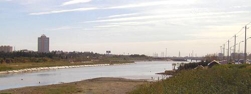
This part of the map would be incomplete if a picture of Wenyu River was not included, so here it is.
Wenyu is a large and wide river starting in the northern mountains of Beijing and ending right here where the photo is taken.
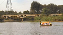
The river is fed by many contributaries. One of these is Ba River, which doubled up as an alternative boat route to Kubilai's magnificent summer capital of Dadu, now Beijing.
The small picture shows where Ba River joins up with Wenyu River less than four kilometers upstream (north) of the above point.
Oh, the little boat? The local golf course is located on both banks of Wenyu River, so it ferries golfers from one bank to the other.
You are looking at the very first (or last) flow of the famous Grand Canal, aka. The Imperial Way.
The idea of making large scale canals is as old as civilization itself, but the length of China's Grand Canal was so huge that it dwarfed just about any other similar project.
The objective itself was simple: The south was rich on resources and grain but the north was arid and could not on its own sustain the population needed to maintain the geopolitical importance of the north.
So what do you do? Since water transportation is cheap you take advantage of the existing river system to build a canal to ferry product from south to north.
Outdated concept, you'd think? The vast majority of all trade transport to this very day is by water! Think container shipping.
Or stay local in China and consider that it remains far cheaper to transport goods down the Yangtze river than using road or railway.
Here is the historic intersection between three crucial waterways, which together was the very lifeline for China's capital.
In the center is the bridge spanning the Tonghui Canal, which canal secured an efficient, economic and constant flow of commodities and grain to the population of the capital.
On the left of the photo is the northern terminal of the Grand Canal, which enabled the transport of crucial resources from the south to the north.
And on the right is Wenyu River, which through its tributaries almost eliminated flooding of the capital and the consequent loss of life, buildings and food.
Considering the historic importance of this location one can wonder why so little commemoration is present. You'd be hard pressed to even find a small inscription or a marker.
By the way, this was a darn difficult photo to get, which is almost obvious from the foreground. And then to have the luck of an airplane heading for Beijing at the time of the shutter release ...
- Point and click on the canal sections just below to change to that section